Place
Chesapeake Bay Bridge at Kent Island
The Chesapeake Bay Bridge at Kent Island is Maryland’s great threshold between the Western Shore and the Eastern Shore. Officially the William Preston Lane Jr. Memorial Bridge, the dual-span US 50/301 crossing links Sandy Point near Annapolis with Stevensville on Kent Island and reshaped travel, tourism, commuting, and local life across the Chesapeake.
The Chesapeake Bay Bridge is one of Maryland’s defining pieces of infrastructure and one of the most recognizable gateways to the Eastern Shore. For travelers heading east, the bridge’s Kent Island landing is the moment when the road leaves the metropolitan pull of Annapolis, Baltimore, and Washington behind and arrives on the Shore side of the Chesapeake.
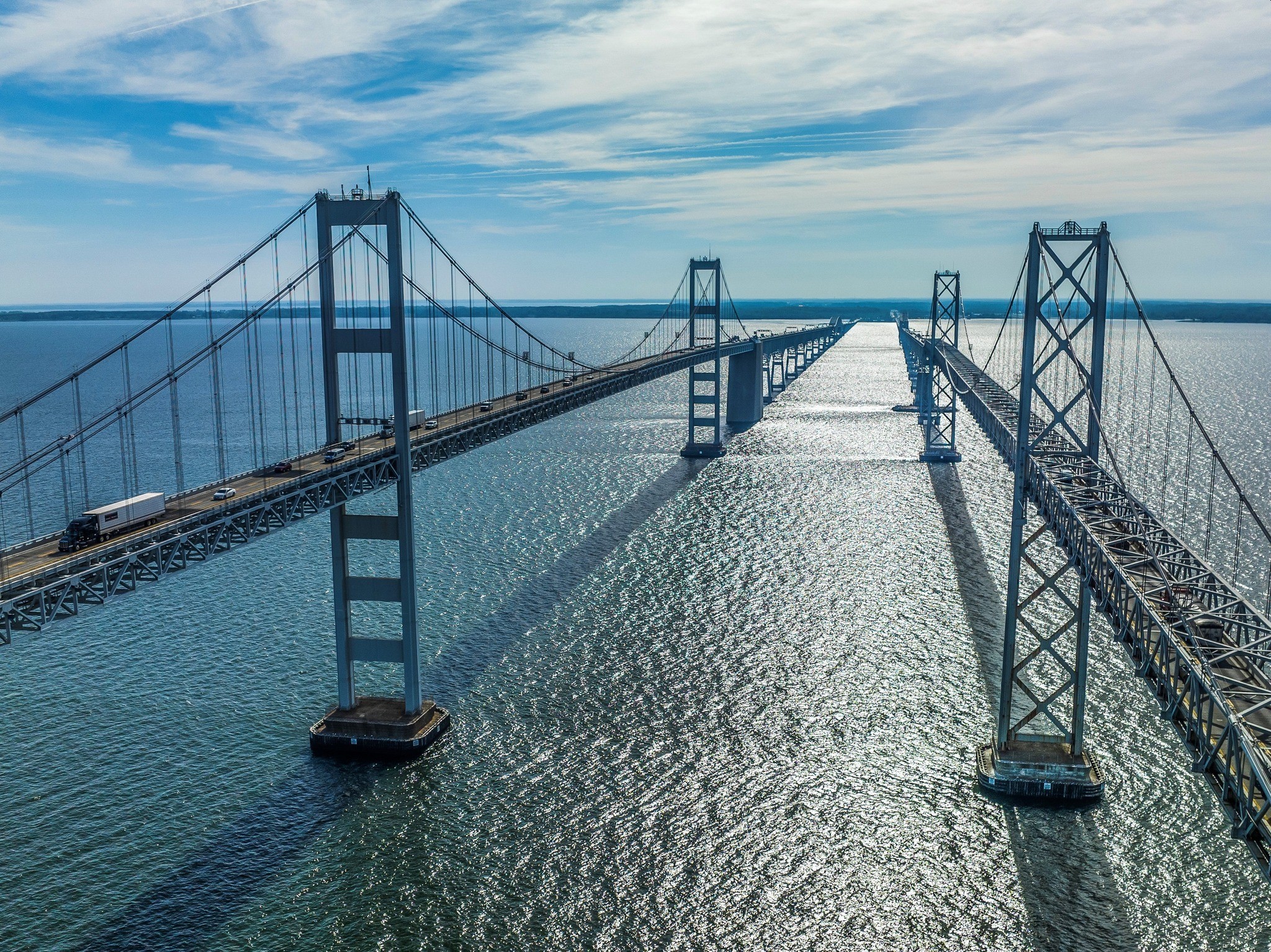
Officially named the William Preston Lane Jr. Memorial Bridge, the Bay Bridge carries US 50/301 across the Chesapeake Bay between Sandy Point in Anne Arundel County and Stevensville on Kent Island in Queen Anne’s County. The Maryland Transportation Authority describes the dual spans as a direct connection between Maryland’s recreational and ocean regions on the Eastern Shore and the metropolitan areas to the west.
The bridge is often treated as a traffic fact, but it is also a place of memory and transition. Before the bridge, crossing the Chesapeake depended on boats and ferries. Maryland Transportation Authority history notes that the Chesapeake had once served as a highway and market house for tidewater Maryland, connecting settlements by water. As roads, railroads, automobiles, and trucks became more important, the bay increasingly became a barrier between the Eastern Shore and the rest of the state.
Regular ferry service eventually linked the Annapolis shore with the Eastern Shore, including service to Matapeake on Kent Island. But ferry travel could not fully meet the demands of a modern highway age. Long-running bridge proposals rose and fell through the early twentieth century, delayed by financing problems, the 1929 stock-market crash, and World War II. Under Governor William Preston Lane Jr., Maryland finally moved the project forward after the 1947 General Assembly directed the State Roads Commission to build a bay crossing.
The original eastbound span opened on July 30, 1952. MDTA notes that at the time it opened, the bridge was the world’s largest continuous over-water steel structure. That first span changed the geography of Maryland in practical terms. It made the Eastern Shore more reachable by car, altered travel to beaches and resort towns, and tied Kent Island more tightly to statewide traffic patterns.
The parallel westbound span opened on June 28, 1973, after traffic growth made the original crossing insufficient. Today the bridge functions as a dual-span facility, with the original two-lane span generally carrying eastbound traffic and the newer three-lane span carrying westbound traffic. During heavy eastbound travel periods, one lane of the westbound bridge can be reversed for two-way traffic operations.
At Kent Island, the bridge is more than a line on a map. It lands in one of the Chesapeake’s oldest and most historically layered communities, then feeds into Stevensville, Chester, Kent Narrows, and the rest of Queen Anne’s County. For many visitors, the first sight of Kent Island after the bridge signals arrival on the Eastern Shore. For residents, it is also a daily force: a route to work, a traffic pressure, a tourism engine, and a constant reminder that island life changed permanently when the fixed crossing arrived.
The bridge’s scale still matters. MDTA lists the shore-to-shore length, including causeway, at 4.35 miles for the eastbound span and 4.33 miles for the westbound span. Its towers, grades, winds, lane-control operations, and wide-open bay views make it memorable even for people who cross it often. Some drivers find it thrilling; others find it stressful. Either way, few Maryland road crossings carry so much emotional geography.
For LifeOnTheShore, the Chesapeake Bay Bridge at Kent Island belongs in the place guide because it helps explain the modern Eastern Shore. It opened access, supported tourism, and changed travel habits, but it also brought growth, congestion, and new pressures to island communities. It is a marvel of engineering and a cultural dividing line: the place where “going to the Shore” becomes physically real.
A thoughtful view of the bridge should hold both truths at once. It is beautiful and burdensome, useful and disruptive, historic and still intensely current. From Kent Island, it frames the Chesapeake as both connection and crossing — a body of water that once carried people by boat, then separated them by distance, and now funnels millions of vehicles each year over one of Maryland’s most consequential spans.